-
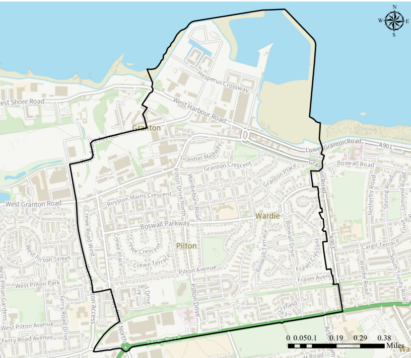
Area map
The map below shows the area covered by Granton and District Community Council. Please note that, following boundary changes that came into force at the end of March 2025, Ferryfield and West Ferryfield now fall within our Community Council’s area.
If your street is not clearly visible on this map, take a look at the City of Edinburgh Community Council’s interactive map via this link. Simply enter your postcode and press search to be taken to your Community Council.
-
Area profile and demography
According to information supplied by City of Edinburgh Council, our community council covers an area of 2.65 square kilometres, with a total population of just over 14,000 people (based on mid-2022 estimates from National Records of Scotland).
-
History of Granton
Granton is a district in the north of Edinburgh, Scotland. Granton forms part of Edinburgh’s waterfront along the Firth of Forth and is, historically, an industrial area having a large harbour. Granton first appears on maps in the 17th century relating to the now demolished Granton Castle. The name also appears in Granton Burn, which now runs through Caroline Park down to what was Granton Beach. The name is presumed to come from Grant’s Town or Grant’s Dun/hill. (Wikipedia). Please find more information about history of Granton at www.grantonhistory.org